Getting here: four ways in
The hotel stands on Fort Road NW in north-east Edmonton, a short walk from Belvedere LRT station. This chapter covers the airport, the train, the car and the last few hundred metres on foot, with a Google Maps route for each start point.
6.AThe address and the map
| Street address | 13103 Fort Road NW, Edmonton, AB T5A 1C3 |
|---|---|
| Phone | 780-643-4000 |
| Map pin | 53.58967, −113.43258 (Google Maps card for the hotel) |
| Nearest LRT | Belvedere station, Capital Line, at Fort Road and 129 Avenue |
| Parking | Free; heated underground garage and surface lots |
Map by Google Maps: Century Casino & Hotel Edmonton, 13103 Fort Road NW, Edmonton, AB T5A 1C3. Open in Google Maps ↗ · Directions in Google Maps ↗
On the map, the hotel is the large building on the south-east side of Fort Road NW between 129 Avenue and 132 Avenue. The rail and LRT tracks run behind it, and Belvedere station is to the south-west, near 129 Avenue. We checked the pin against the Google Maps card for the hotel on 30 October 2026; it sits on the building.
6.BFrom Edmonton International Airport (YEG)
- By car or rental. About 39 km and roughly 42 minutes without traffic, by our calculation from the airport to the hotel's map pin.
- By taxi or limo. The airport says taxis and limousines wait at the curb outside Door 9 on the Arrivals level. It publishes flat rates to downtown Edmonton — $62 by taxi, $71 by limo — and a zone map for other areas. Fort Road is not downtown, so the zone rate applies; ask the driver to confirm the fare before you leave.
- By bus and train. ETS Route 747 links the airport with Century Park Transit Centre seven days a week from about 4:10 am to 12:30 am, every 30 to 60 minutes, leaving the airport from Door 8. The City lists a $6 fare payable by Arc, bank card or cash, and notes that a cash fare includes no transfer. At Century Park you are at the southern end of the Capital Line; ride it north through downtown to Belvedere.
- Allow time. The bus-and-train route has the longest journey time of the three. It is the cheapest, and the train runs all the way to the station beside the hotel.
6.CBy LRT
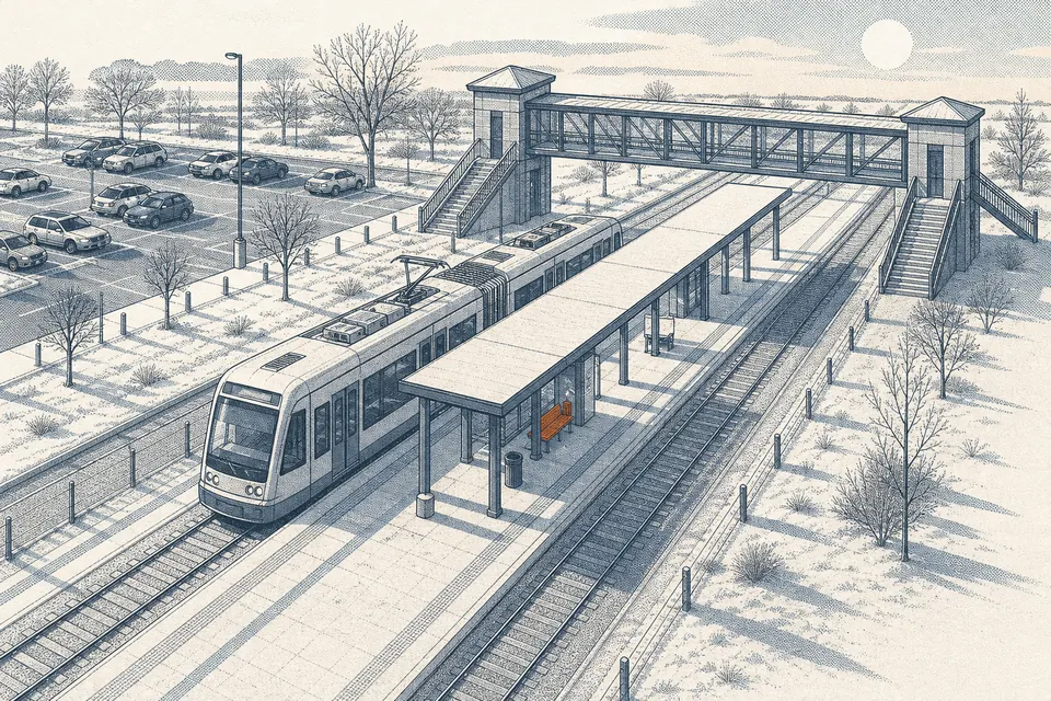
Belvedere is a ground-level station on the Capital Line at Fort Road and 129 Avenue. It is one of the five original stations of Edmonton's light rail, opened in 1978, and was rebuilt in 1998 with a covered platform and a pedestrian overpass; the Belvedere Transit Centre sits on its west side. From the station point to the hotel's map pin we measured about 160 metres in a straight line. The walk itself is longer because you follow streets and crossings: on 1 November 2026 Google Maps showed about 550 to 600 metres, roughly 8 minutes on foot, via the Belvedere Transit Centre or 129 Avenue and Fort Road NW. Use the walking route below for the current path.
6.DBy car
- Arriving from downtown. About 7.5 km from Rogers Place, roughly 12 minutes without traffic by our calculation.
- Arriving from West Edmonton Mall. About 18.9 km, roughly 25 minutes.
- Arriving from Fort Saskatchewan. About 23.7 km to the town-centre point we used, roughly 24 minutes. Fort Road was historically the road between the two places, which is how it got its name.
- Parking. Free, with a heated underground garage. Section 6.1 has the numbers.
6.ERoutes in Google Maps
Each link below opens Google Maps with the start point filled in and the hotel as the destination. Times in Google Maps take live traffic and the current timetable into account, so they will differ from our calculations, which assume an empty road.
- From the airport by car — about 39 km. Route in Google Maps (driving) ↗
- From the airport by Route 747 and the Capital Line — the cheapest way in. Route in Google Maps (transit) ↗
- From Belvedere station on foot — about 550–600 m, roughly 8 minutes. Route in Google Maps (walking) ↗
- From Rogers Place by transit — after an Oilers game or a concert. Route in Google Maps (transit) ↗
- From Commonwealth Stadium by car — about 5.4 km. Route in Google Maps (driving) ↗
6.FArriving late
- By train. The airport bus runs until about 12:30 am. If your flight lands late, check the last connection before you rely on it, or plan on a taxi.
- By car. The casino is open around the clock from Friday to Sunday and until 4 am on other nights, so the building is not dark when you arrive. The hotel does not publish check-in hours; say your arrival time in the form.
- On foot from the station. Use the walking route above and the main entrance; the hotel does not publish a separate hotel entrance.
6.GRelated sections
Directions and contact details are also on the hotel's official site.Official site: cnty.com/edmonton ↗
- Century Casino & Hotel Edmonton home page (cnty.com), archived capture of 11 Sep 2026
- Google Maps card for the hotel, read 31 Oct 2026
- Edmonton International Airport — ground transportation, read 31 Oct 2026
- City of Edmonton — Route 747 airport service, hours and fares, read 31 Oct 2026
- Wikipedia — Belvedere station (secondary source)
- Wikipedia — Capital Line (secondary source)
- Wikipedia — Fort Road and Manning Drive (secondary source)
- Drive distances and times: our own calculation on the public OSRM router from the map pin, without traffic, 31 Oct 2026